Orienteering Map In Forest Puzzle and Coloring Page
This page belongs to Snow, Ice & Outdoor Adventures, a complete 30-page build, color, and frame collection.
About This Jigsaw Puzzle
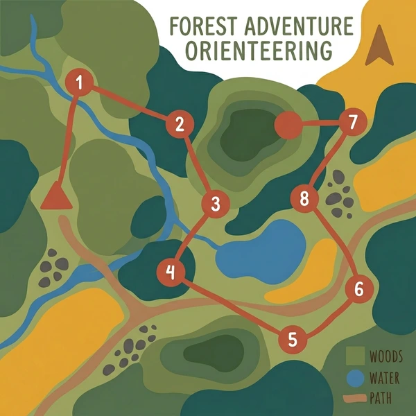
A detailed orienteering map fills the frame, its carefully coded symbols showing a complete forest race course. Green areas represent dense woodland, blue marks water bodies and streams, and yellow-brown lines trace the paths and open terrain between eight numbered checkpoints. The map is a work of functional art that tells a whole story of a race route through the trees.
Coloring Tips
Use the standard orienteering color scheme: fill forest areas with green, water features with blue, open land with yellow, and paths with tan or light brown using the fill tool. Mark each numbered checkpoint circle in red or orange for high visibility. Brown contour lines complete the authentic topographic look.
Common Questions
What is orienteering and how is it scored?
Orienteering is a navigation sport where participants use a detailed map and compass to find a series of control points placed in the landscape as fast as possible. Scoring is based on finishing time. Missing a checkpoint results in disqualification in most formats.
What does each color mean on a standard orienteering map?
Orienteering maps use a universal color code: white for navigable forest, green for dense vegetation, yellow for open ground, blue for water, black for man-made features and rocks, and brown for contour lines showing terrain relief.
How should I color the checkpoint circles on this orienteering map puzzle?
Paint the numbered control circles in orange or red using the brush tool, as this matches the standard color for control markers and circles on official orienteering maps. The contrast against the green forest makes each checkpoint easy to spot.
Can I play Orienteering Map In Forest for free?
This page is included with Snow, Ice & Outdoor Adventures. You can first play the book's designated sample for free.
Is a printable coloring book included?
Yes. Buying Snow, Ice & Outdoor Adventures includes its complete 30-page printable PDF in A4 and US Letter formats.
More Sports Puzzles

You Might Also Like
Explore More Categories
Love this art page?
Open Snow, Ice & Outdoor Adventures to see its complete collection and your next page.
